Read Nigel’s reflections on cycling, history, remembrance and the landscapes of the Western Front, including mental preparation for visiting the horrific battlefields and memorials to the loss of countless young lives. With personal observations and those of a like-minded explorer of Great War history (Tom Isitt), these posts offer further insight into the journey behind The Road of Hope and Sorrow, and Nigel's wider interest in exploring history by bike.
I wanted to find out what Tom might make of my adventures along the Western Front and how I had written these up in The Road of Hope and Sorrow. I felt it would be worthwhile sharing what another author with an enduring interest in the Great War, and who is clearly also committed to the concept of exploring history by bike, might have to say.
Here are Tom’s comments:
I’ve read a dozen or so books about travelling the Western Front of the Great War, from an immediate post-war pilgrimage by Henry Williamson to more recent walks by notables such as Sir Anthony Seldon. I even wrote my own book about cycling the Western Front in the wheeltracks of the 1919 Circuit des Champs de Batailles bike race. I’ve visited the Western Front more than 20 times, and feel I know it quite well.
Many of these books follow an established pattern, interspersing a bit of Great War history with a lot of the author’s more or less interesting observations and anecdotes. So, when I received a review copy of The Road of Hope and Sorrow, I was interested, but not hopeful that it would add much to the genre. I was very wrong.
The first surprise was the size of the book, a large-format paperback with 536 pages, weighing 1.27kg. It definitely passes the “drop test” — it makes a hefty thud if you drop it on a coffee table. The next surprise was the sheer quantity and quality of photos, maps, and illustrations: more than two hundred contemporary photos and almost sixty archive images, thirty maps, nine war art reproductions by the likes of Anna Airy, Olive Mudie-Cooke, Paul Nash, Richard Jack and Otto Dix, and ten wonderful line-drawings by the author.
Nigel Bruce is clearly a very accomplished photographer, cartographer, and artist, and the design and layout of the book makes it feel more like a magazine than a book. It’s visually very appealing, and the text is broken up with First World War art, poetry, and tables laying out the progress of various battles in a very clear way.
With regards to the text, I’m not a Western Front expert so am in no position to critique the historical stuff, but I didn’t find any obvious howlers and Bruce’s words are authoritative, but not too dry. The same applies to his cycling narrative, which doesn’t get bogged down with the minutiae of the ride, but gives enough of a flavour to make me want to get back on my bike and head for France and Belgium. But in some ways the cycling is almost incidental, it doesn’t overwhelm the rest of the book, and this book would work equally well as a driving companion.
Another thing I really liked about The Road of Hope and Sorrow is each chapter begins with a sort of list of what’s in the chapter. This was very common in books published at the beginning of the 20th century, and is a nod in the direction of old-style publishing in a very modern-looking book.
It’s been quite a while since I read something that really wowed me, but The Road of Hope and Sorrow did just that. Some of his observations about the benefits of cycling the battlefields, and making maps of those battlefields, really struck a chord with me, and as I read it I felt that we are very like-minded battlefield tourists. The multi-talented Bruce has produced something very engaging, visually appealing, and readable.
Tom Isitt Historian, explorer, photographer, and author of two recent books themed on exploring the Great War by bike:
Riding the Zone Rouge: Cycling’s Toughest-Ever Stage Race (Weidenfeld and Nicolson, 2019)
Thunder in the Mountains: The First World War on the Italian Front (Helion Books, 2026)
Once I have completed reading Thunder in the Mountains, I’ll add some of my thoughts here on this fascinating book. Perhaps the first thing to say is that Tom Isitt’s book is very welcome, indeed long overdue, as despite the political importance of the Italian Front and the vast human cost of the fighting in some of the most appalling conditions, in comparison with what is available for the Western Front, there is very little out there to inform and guide travellers wishing to explore the mountain battlefields and Great War history of the conflict between Italy and the Austro-Hungarian Empire.
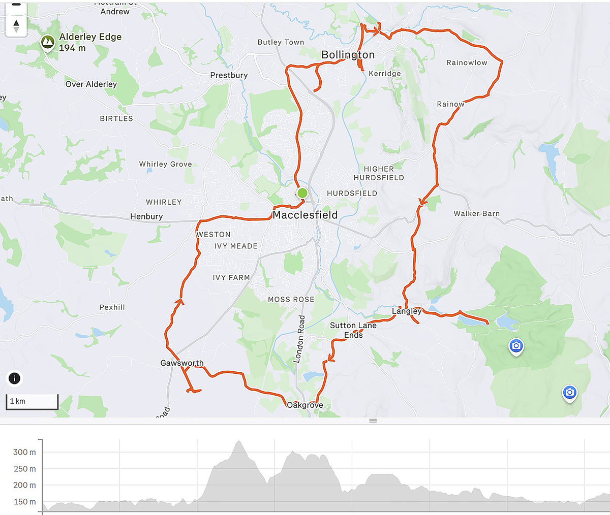
Map of my Day 2 ride, starting from Macclesfield, and another very hilly itinerary, quite hard work on the bike but a great way to appreciate the nature of the landscape
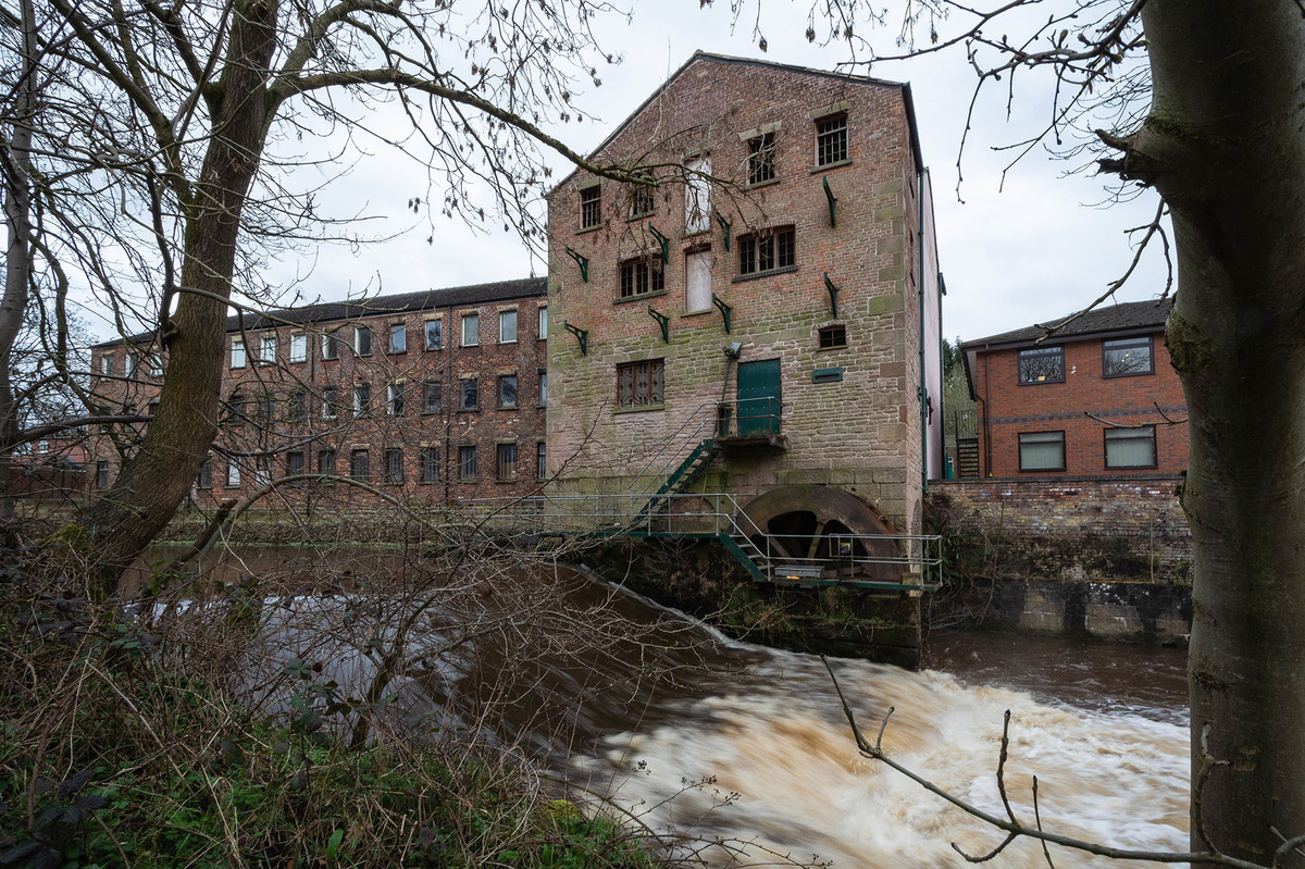
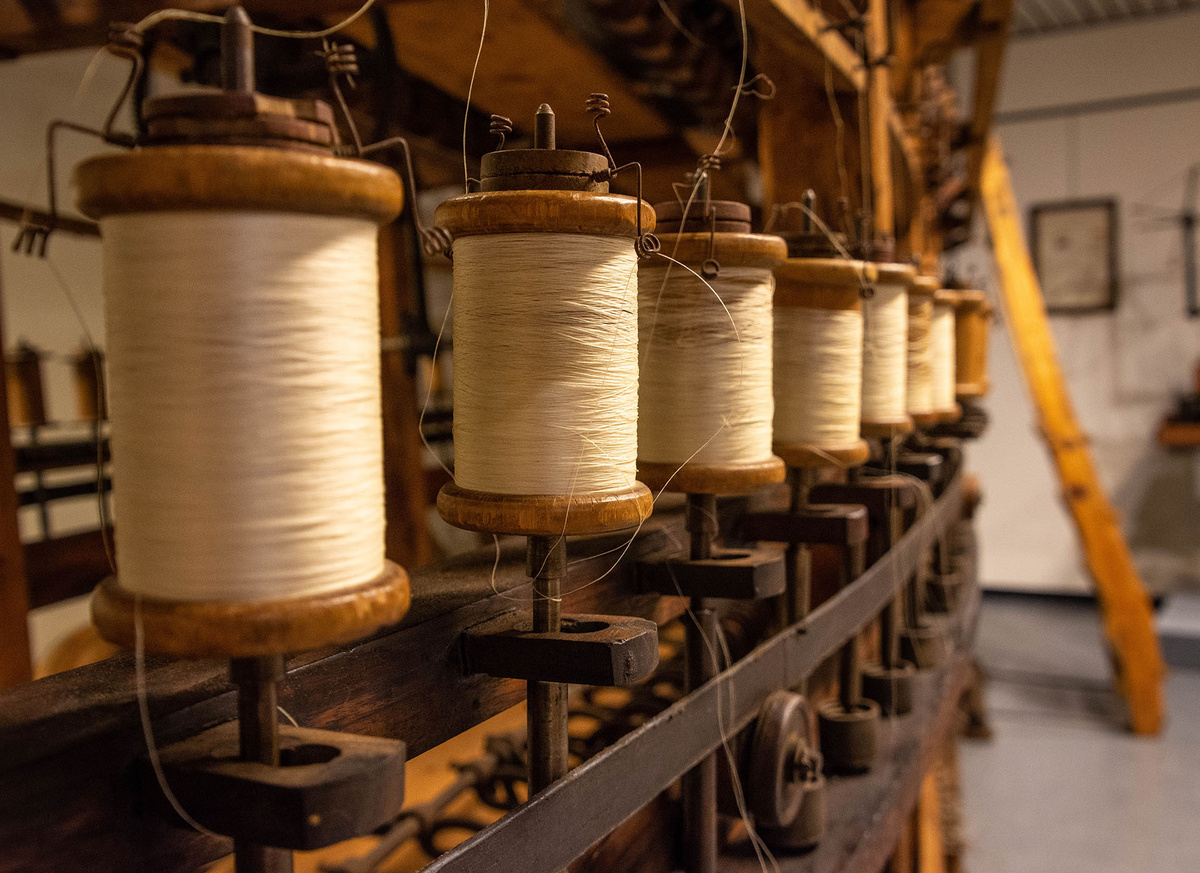
On my tour, I visited another one of the Cheshire’s (at that time) thriving textile companies, RA Smart Holdings of Bollington, which specialised in patterned weaving and printing of silk and other fabrics. It is fittingly situated beside the old Adelphi Silk Mill, the Macclesfield Canal and the former railway which is now the Middlewood Way.
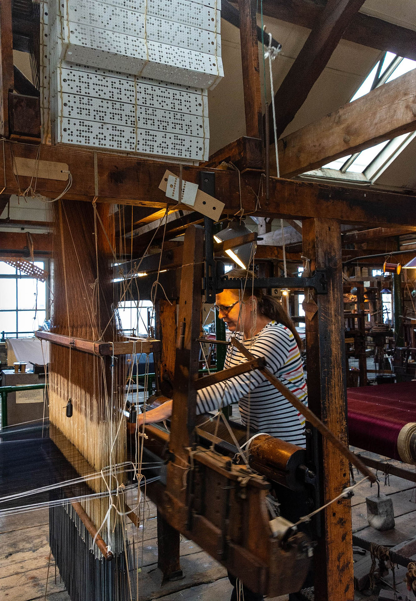
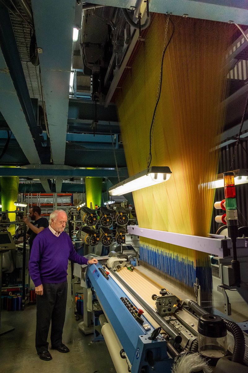
The owner, Ron Smart, whom I met and who kindly showed me around the factory, brought a silk screen printing concern here from northern Italy after working there for a several years, and developed this through the 1980s. He had developed sophisticated silk screen, acid dye and digital printing facilities and was running four Jacquard looms producing, among other designs, the sought-after ‘Macclesfield Neats’, so favoured for ties.
Ron Smart casts an experienced eye over one of his four Italian SMIT Textile silk looms with computer-controlled Jacquard heads
Glancing up at the portrait of Joseph Jacquard in his office, he explained that he still values his links with Italy; “I have taught the staff, all of whom are local, but my source of knowledge is from Como, my mentors are in Como”.
Watching the high-speed looms in operation was an impressive sight, especially as I reflected that the Jacquard ‘heads’ were simply an up-to-date version of an early 19th Century invention, controlled by software and computers rather than punched cards. The looms and most of the other technology that Ron Smart uses are all European, with the exception of the digital printers which are Japanese.
“The British technology is long gone, long gone”, he mused. “I chose the Italian Jacquards and looms so I could always ring them and say what do you think ...”.
While China remains the source of Ron Smart’s raw silk, the thread is processed in Italy; “I use an Italian supplier because of the quality”, he said, adding that “this is particularly important for the warp threads - the looms run so much better”.
Like Adamley, Ron Smart’s textile business seemed to be thriving at the time of my rides and visit to the factory , reaching markets in Europe, Asia and the US, and he felt that his personal links were strong enough to protect him against future changes in trade relationships with Europe (i.e. from Brexit). Sadly, however, in April 2026, RA Smart (Holdings) became insolvent and is currently in administration, with the industrial units and machinery up for sale, so this silk weaving and printing business has finally closed down and joined the long list of local silk enterprises that eventually fell victim to economic and political forces. I recently met with Ron Smart again at his office where he is managing all the affairs of wrapping up the business. “ We lost business during the Covid pandemic,” he said, “ and sadly it never properly recovered, “So with fixed costs rising, it has not been possible to maintain a sustainable business, and our closure will leave a big hole as there is no one else in the country doing the weaving and printing (especially the acid dye printing of fabrics such as cashmere wool) that we were able to produce”. I asked exactly which among these ‘fixed costs’ were the culprits, to which he replied “Well, the usual … it’s increasing labour costs, with higher national insurance and pension contributions, and energy – we pay far more for energy here in the UK than they do in Europe and it’s not easy there either.” The portrait of Joseph Jacquard, I noted, still hangs above the desk in Ron’ Smart’s office.
Historically, the fortunes of Macclesfield’s silk industry have fluctuated greatly with events across the Channel. Huguenot (French protestant) refugees brought their silk weaving skills, and Charles Roe kick-started the industry with Italian technology. The 18th and 19th Century wars with France reduced access to the French silk desired by wealthy English women, so promoting the local manufacturing; at the same time, these conflicts delayed the adoption of Jacquard’s transformational technology in England. Business then boomed, until the late 1820’s when European free trade agreements reduced tariffs on imported French silk. There were further ups and downs, with production of parachutes in WW2 (until the use of nylon started in 1942), then decline once more as textile manufacture moved to Asia.
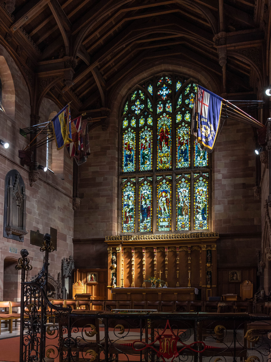
The memorial window to Martha Brocklehurst in St Michael's church, Macclesfield
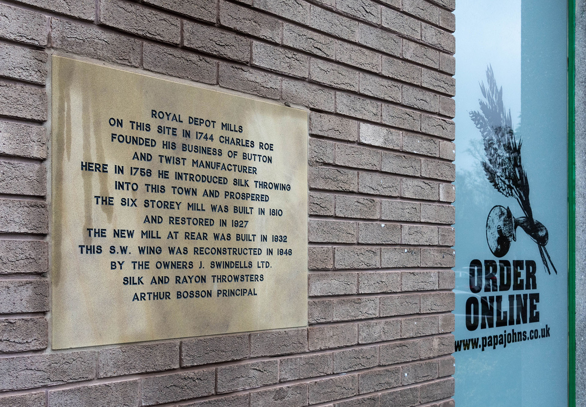
Cycling back into Macclesfield, the traces of silk are everywhere in the street names and buildings. Among the highlights are the weaver's houses in Paradise Street, Charles Roe House (now a wellbeing centre and cafe), and the Sunday School for the silk workers’ children. Among the churches are St Michael's with its memorial window to the Brocklehurst family, and Christ’s Church which was built by Charles Roe and is where he is buried.
Opposite the Travel Lodge, itself converted from the former Royal Silk Warehouse, is the extraordinary Grade II* listed Arighi Bianchi building.
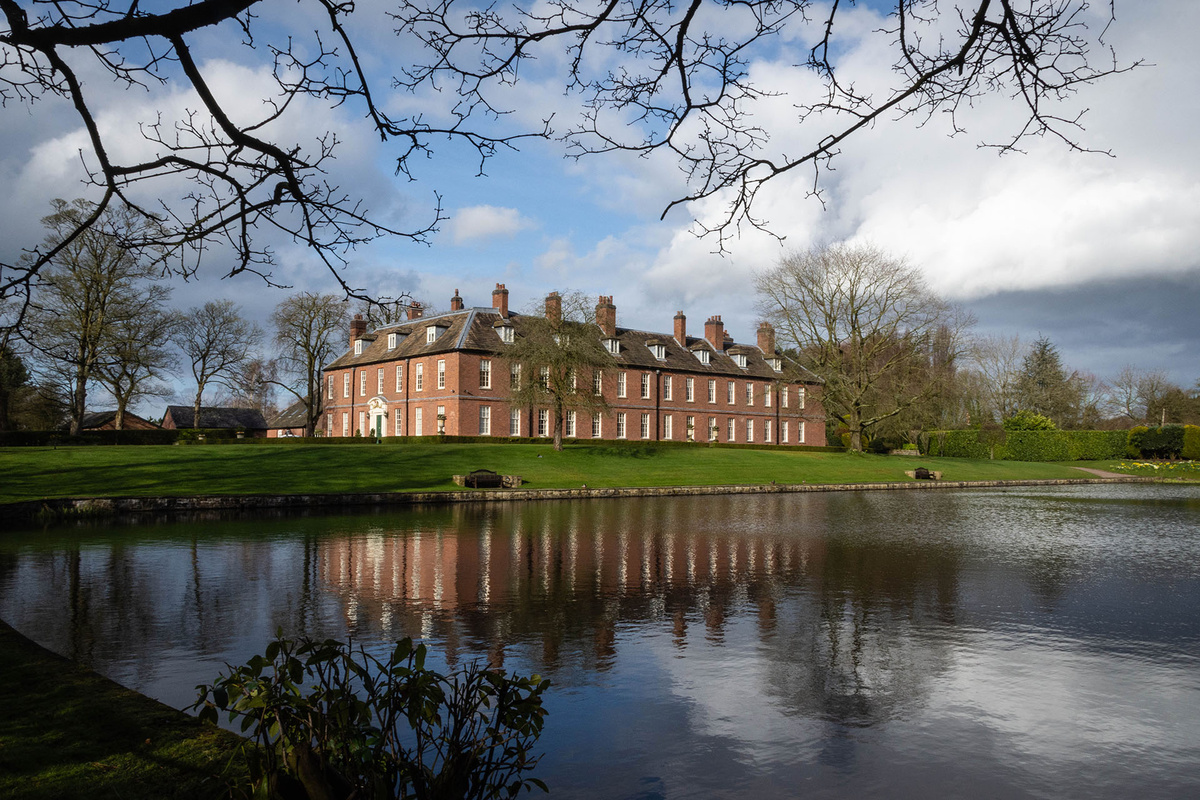
This architectural delight [illustrated in the header photo], best appreciated in the evening light, is another reminder, as if one were needed, of Macclesfield's links to the world of European silk and the impact of refugees fleeing conflict.
Antonio Arighi and his nephew Antonio Bianchi originally came from the silk village of Casnate on the shores of Lake Como in 1854 to escape the Italian civil war and established themselves as cabinet makers.
Macclesfield is looking to promote its links with China, building on its past and current industrial heritage, and on the idea of being located at the western end of ‘The Silk Road’ stretching from the Far East to Europe.
One other active silk business (supplying high quality silk, and patterned fabrics that were being printed by RA Smart’s company in Bollington) in this part of Cheshire is Bennett Silks based a little further north in Stockport. Established in 1904 by William Henry Bennett in Manchester, it is according to the company’s website, still entirely in the Bennett family's hands, run by William Henry Bennett's great grandson Mike and his wife Joyce, who are leading the company through further expansion with the establishment of substantial silk weaving interests in Europe, India & China.
The company web site goes on to describe their contemporary European partnership, and how in 2016, ‘a fifty percent shareholding was purchased in French weaving mill FCN Textiles, giving Bennett Silks its own European production facility in the heart of the French silk area in Fourneaux, a town to the northwest of Lyon. This acquisition proved even more beneficial in 2021, enabling the creation of Bennett Silks Europe to counter the extra charges and complications inflicted on EU customers since Brexit. Bennett Silks' EU customers can continue to order safe in the knowledge that their goods will be delivered exactly as they always have been with no extra charges or delays.’
All of which further emphasises the importance of connections of our island nation with the continent of Europe, and not just for silk.
This website uses cookies to ensure you get the best experience. Would you like to enable cookies on this site?
Get in Touch
Whether you have a question about The Road of Hope and Sorrow, would like to discuss Nigel Bruce’s journey along the Western Front, or are interested in inviting him to speak at an event, please use the form below to get in touch.

 A transformational technology
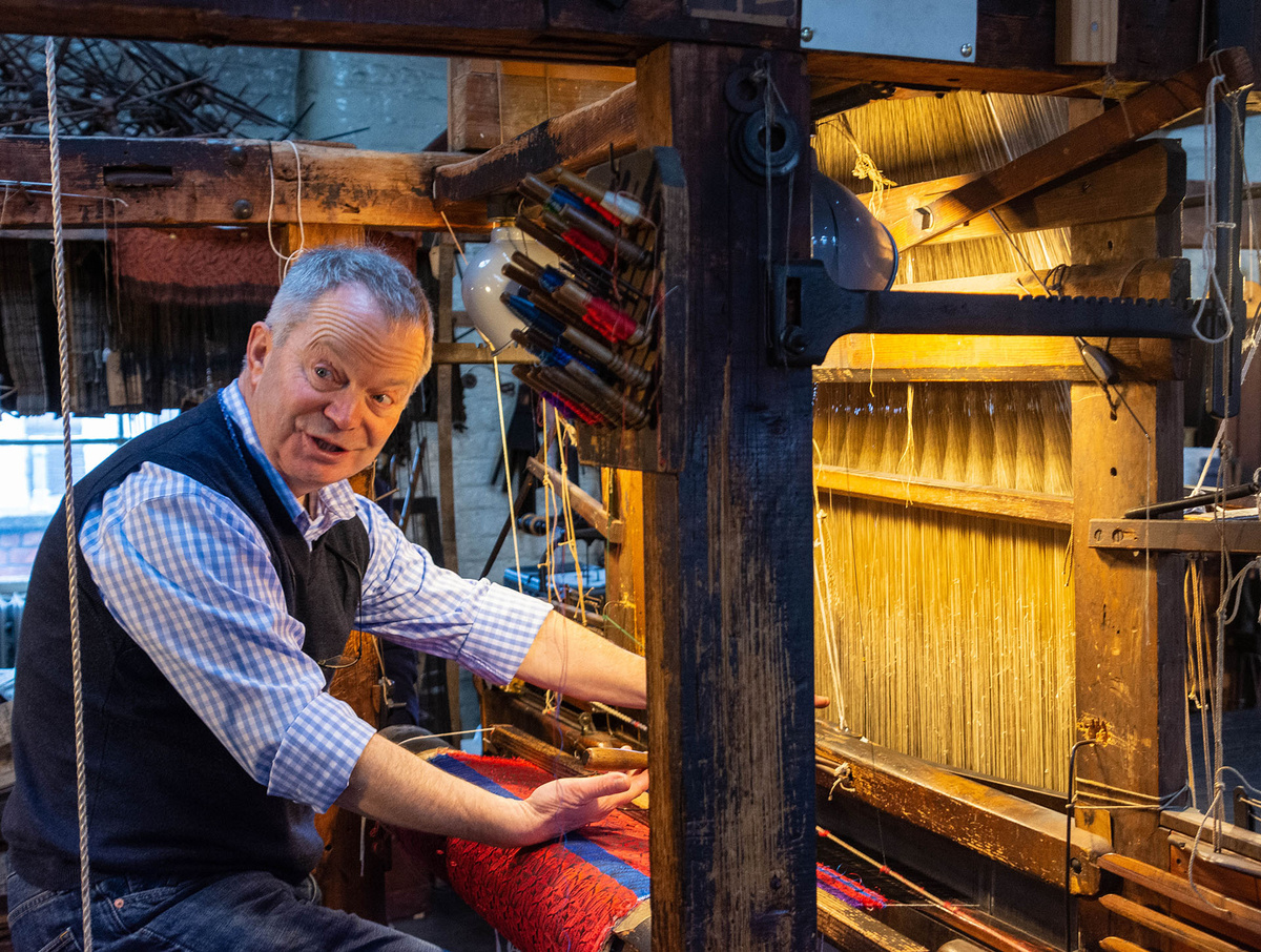
![Day 1 ride: Map of my southern loop ride starting from Bollington. The profile graphic shows the very hilly nature of this part of Cheshire [ recorded in Strava]](https://assets.netl.io/media/bruce/Silk_route_map_A_southern_loop_PS_Crop_300_dpi_1920_px.jpg)