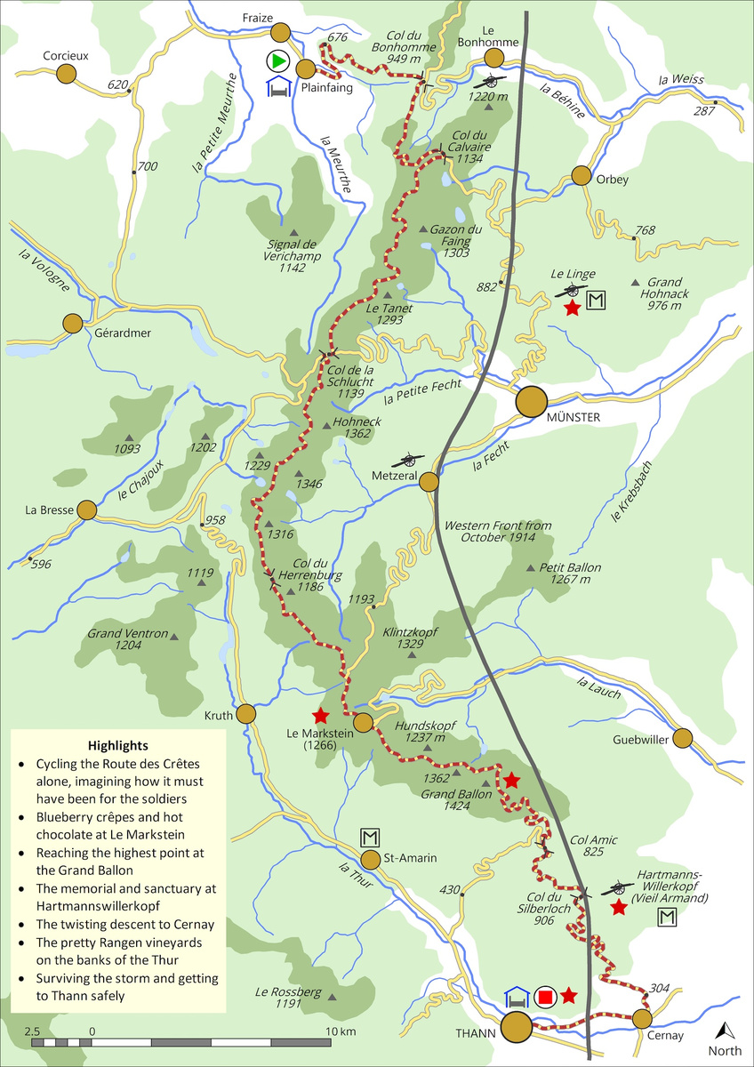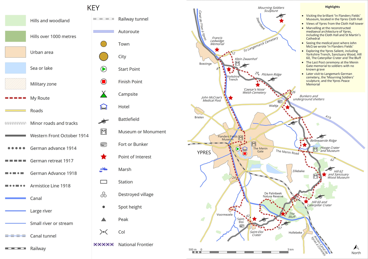
With this Western Front project, maps were, for me, another very important part of telling the story, and one that I hope will help others planning trips to all or part of the Western Front. Creating these maps (for which I used MapMaker Pro Version 4), brought me much closer to the landscapes I had cycled through. Many hours spent tracing the course of rivers, identifying towns and villages – some of which vanished in the maelstroms of shellfire and exist now only as villages détruits (destroyed villages) – historic features, hills and woodlands, helped me understand the physical and human features of the terrain, and complemented accounts of the battles that were fought across these lands. I have included two of the day-ride maps from my book here by way of example, together with the key that explains the symbols used and information I have sought to provide the reader.